Home >
The Green
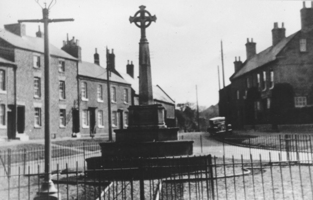
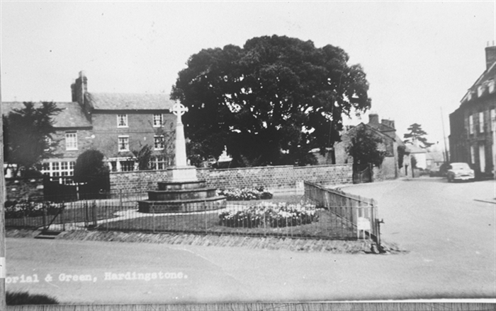
Several views of and from The Green. The first two are clearly before 1914, as there is no memorial. The others show the area after the war memorial has been erected in the 1920s.
The following view is from The Green looking northwards down Back Lane towards Great Houghton.
The following view is from The Green looking northwards down Back Lane towards Great Houghton.
-WE30b3e04a95.jpg)
The photograph shows a delivery from O.C.Wake, bakers from Far Cotton, known to exist in the Edwardian period. Note the name J. Swannel on No. 1 Back Lane in the background, which will probably be advertising their small market garden.
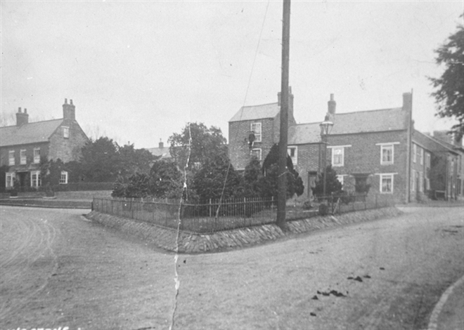
A view of The Green looking from Back Lane before the war memorial was installed, probably just before the Great War. Note that there is a space where numbers 16A and 18 were to be built, and the photo shows the house on the corner of High Street which was demolished later to improve the highway. Note the window cleaner, the horse droppings and the gas light.
This photograph looking south towards The Warren appears to date from just before the second world war. Note the gas lamp in the foreground.
A view of The Green taken in the late 1950s looking down Back Lane towards Houghton Hill, with Mulberry House visible in the distance. Note the tap in the foreground. The gas lamp and telegraph/electricity pole have disappeared.
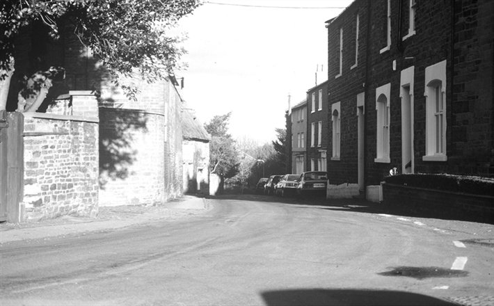
Another view of Back Lane viewed from the war memorial, taken in the late 1980s. Mulberry House has disappeared and has been replaced by houses in Ilex Close.
A later view of the west side of The Green, showing (on the right) the Baptist Chapel after conversion into a house. The date is probably around the millenium.
Back Lane
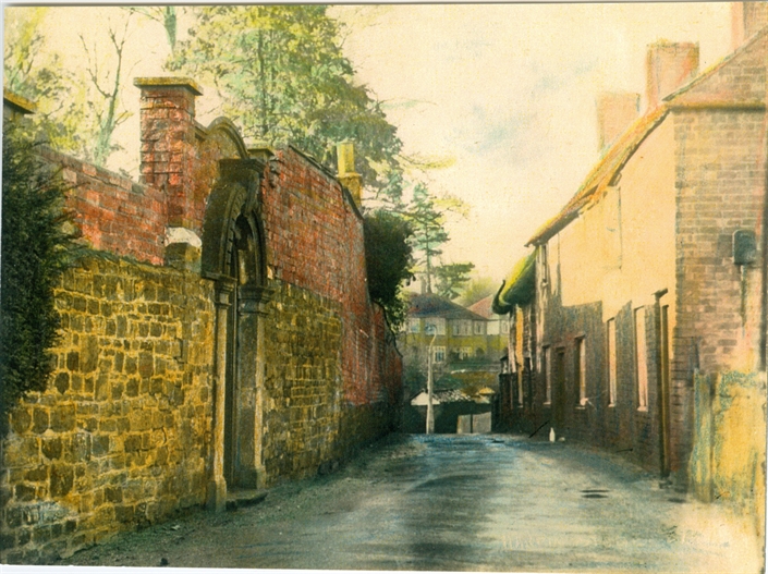
Back Lane is one of the oldest and most quaint streets in the village, running from the and of the white rails in High Street across the top of Houghton Hill and up to The Green.
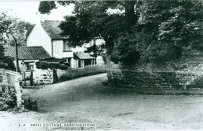
A view looking west towards the High Street and white rails, from around 1970. On the left is the rear entrance to The Hermitage, and on the right a brick terrace that was demolished in the mid 1970s. The white fencing belongs to Swiss Cottage, and there was a communal tap just to the right hand side of the photograph.
A view of Swiss Cottage looking east at the start of Back Lane. On the right is the stone and brick retaining wall on the boundary of The Hermitage grounds. The higher level of soil behind the wall demonstrates that at some point the hillside was excavated to construct the road. The 'road narrows' road sign is positioned at the start of The Portway (Port Lane), which ran down to the wharf on the river Nene at Nunn Mills.
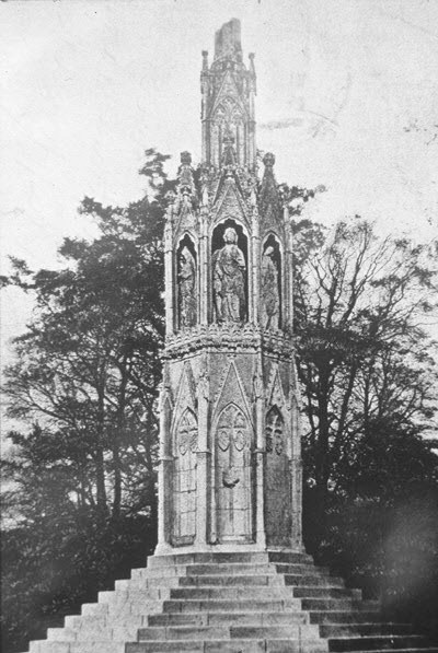
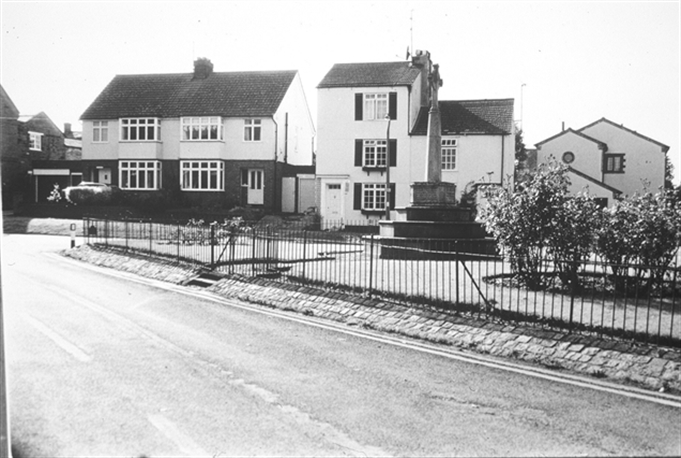
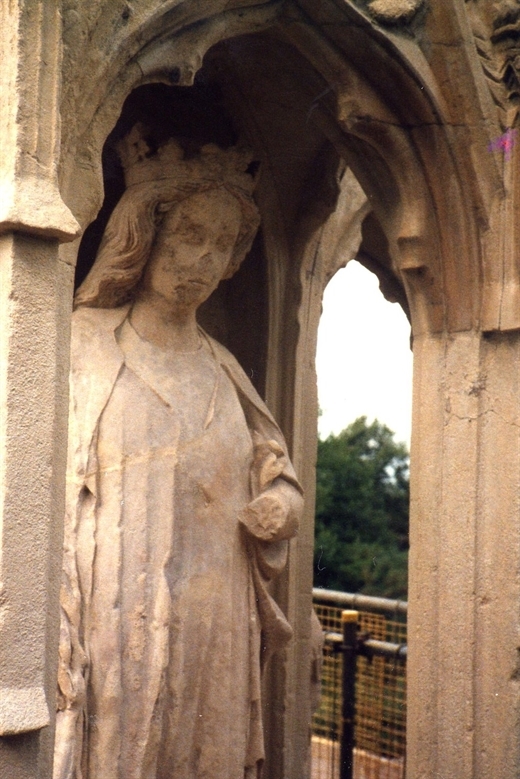
Queen Eleanor's Cross
The cross is one of twelve erected by Edward I at every stopping place of the funeral cortege of his wife Eleanor of Castille on its way to Westminster Abbey for where she died in Lincolnshire. Of the three remaining original crosses, this is one of the two in Northamptonshire, the other being in Geddington.
At the time of writing in 2018, there are plans for the immediate restoration of the monument which is is in a very weathered and neglected condition.
At the time of writing in 2018, there are plans for the immediate restoration of the monument which is is in a very weathered and neglected condition.
These pictures were taken during the 1984 restoration.
-WEfa7951092f.jpg)